City of Vancouver

thumbnail photos and notes

The 18 photographs below were taken July 3, 2009.

(This coming February, Vancouver will host the 2010 Winter Olympic Games.)

a view of Vancouver from
the north shore. (333 kb)

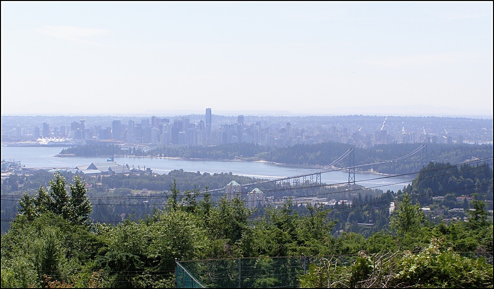
A view of Vancouver from the north shore. Tourist outlooks, like the one on top of Grouse Mountain provide a better view. You get to the top of the mountain by taking a 1.6 km (1 mile) ride on an aerial tram.
I tried to shoot from a sub division, and only luck and a lot of driving allowed me to find a view that was not completely obstructed by trees. So, from this, one of Canada's most affluent neighborhoods (where the big bucks are), they can see the length of East Hastings street, a street that deals in little bucks (spare change), and fails to be mentioned in the tourist brochure. (333 kb)

The Olympic symbol thing (413 kb)

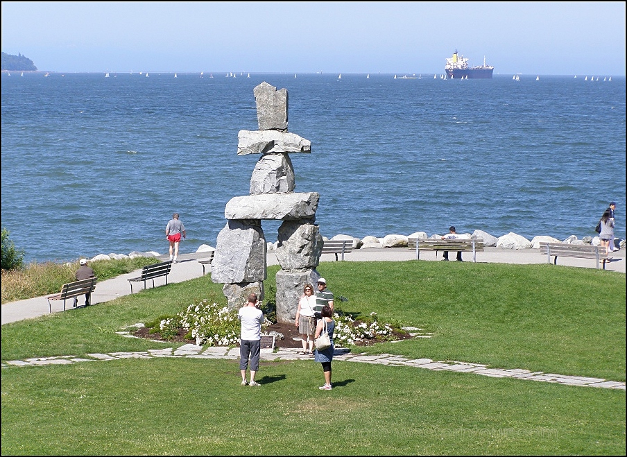
The Olympic symbol called Inukshuk, an Inuit directional marker made of large rocks, and probably errected by a couple of Inuit. Vancouver apparently got a good 2 for one deal, because another Inukshuk sits on top of Whistler Mountain. (413 kb)

The Lions Gate bridge
as seen from 
Stanley park. (444 kb)

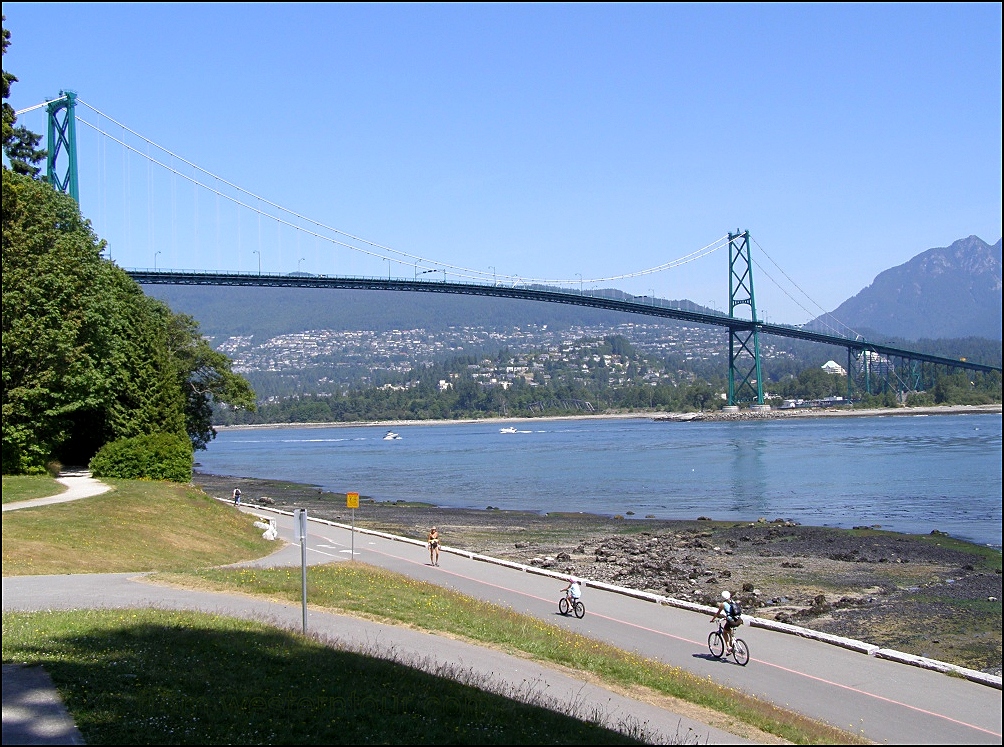
This view of the Lions Gate Bridge and North Vancouver was taken looking north-west from Stanley Park. (444 kb)

the things that are located
 next to the convention centre. (257 kb)

These are the things that are located next to the convention centre. (257 kb)

The harbor with the Trans Canada highway
bridge in the
 background (249 kb)

This is Burrard Inlet with the Trans Canada Highway bridge in the background. (249 kb)

cruise ship in the harbor (263 kb)

A cruise ship docked in Coal Harbour. (263 kb)

float planes are coming
and going all the time, 
probably used as taxis. (435 kb)

This is a terminal for float planes. Planes are coming and going all the time, many headed for Vancouver Isand. (435 kb)

Things next to the warf. (263 kb)

This is Canada Place, built for the 1986 Worlds Fair. Here, you can take a self-guided walking tour of Vancouver's past. (263 kb)

The Vancouver convention centre.  (319 kb)

This is part of Vancouver's new convention centre. (319 kb)

a sightseeing bus in Gastown. (477 kb)

A sightseeing bus ready to provide a tour of the city. It is still early in the morning here in Gastown. Gastown was named after "Gassy" Jack, the first settler of modern-day Gastown. (477 kb)

People walking by the steam
 powered clock in Gastown (406 kb)

People walking by the antique steam powered clock. An early morning photograph taken in Gastown, an area of Vancouver enjoyed by tourists and shoppers. (406 kb)

part of Robson square (397 kb)

This is part of Robson Square, located in the centre of downtown Vancouver. It compliments the Vancouver Art Gallery, which is in the background. The art gallery, with its four floors, is the largest art gallery in Western Canada. (397 kb)

The Hyda totem poles
in Stanley park. (480 kb)

The First Nations totem poles in Stanley Park. (480 kb)

A Vancouver beach at Stanley park. (515 kb)

A Vancouver beach at Stanley Park and part of the 8.8 km (5.5 mile) seawall. The walkway runs around the outside of this park which is located right next to the downtown core. (515 kb)

part of Robson square, 
being renovated.  (426 kb)

This part of Robson Square is being renovated. I had heard that Robson Square was an interesting architectural achievement. But now that I finally see it, I see only renovations. It used to have a dome, a waterfall, and ballroom dance classes on Friday. (426 kb)

the ferry in False creek with 
Granville Island marketplace in
the background. (423 kb)

The ferry that crosses False Creek with part of Granville Island Public Market in the background. (423 kb)

The small ferry docks next to 
Vancouver city centre. (437 kb)

The small ferry docks next to the Vancouver city centre. (437 kb)

playing hockey on inline skates.  (393 kb)

Playing hockey on inline skates with Granville Isand in the background. (393 kb)


Special thanks for much of the above information
goes out to Tourism Vancouver who publish the booklet
"Official Visitors Guide, Vancouver '08 - '09. "


click on this map to return to westerntour - 18 kb


One photograph was first posted June 22, 2002.   Visitors since September 20, 2003 .
Updated all 18 photographs on July8, 2009 when the counter showed 2091.
©2002 Brian M. Brown All rights reserved.   All photographs are marked with almost invisible identifiers.